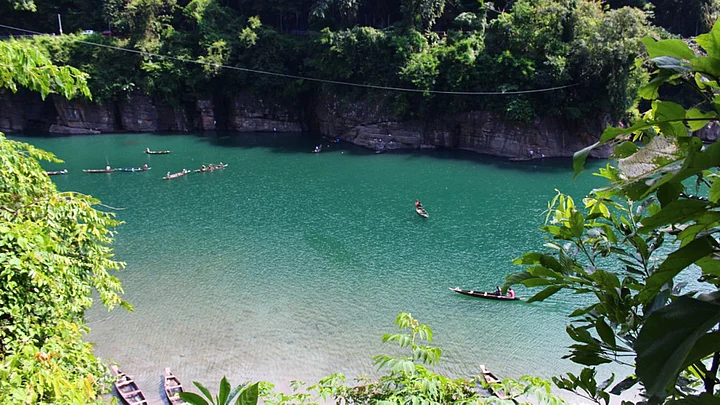
On a trip to Meghalaya recently – a paradise in the hills if ever there was one – I went off the beaten track to discover a little known gem. This was the river Umngot, possibly India’s cleanest river.
How does one get there?
Umngot flows through Dawki, a small but busy town in the East Jaintia Hills district near the Indo-Bangladesh border. The town itself is a mere 95 km from Shillong.
Dawki serves as a busy trade route between India and Bangladesh where hundreds of trucks pass every day.
The Umngot itself is a prime fishing spot for fishermen from nearby areas.
The river is the natural boundary between Ri Pnar (of Jaintia Hills) with Hima Khyrim (of Khasi Hills) over which hangs a single span suspension bridge.
It is the gateway to Bangladesh.
Take a look at the picture below – the water is so clear that when seen from a distance, it appears as if the boat is floating in mid-air!
At a quick glance, however, it becomes evident why India’s extremely porous border with Bangladesh is so hotly debated. There is no fencing, no demarcation; it is, in fact, extremely easy to cross over into Bangladesh (albeit illegally).
In the picture below, the white portion (due to a rise in the current) of the river is an unofficial boundary between the two countries.
According to locals, Bangladeshi fishermen would once cross over to the Indian side to catch fish and collect sand and stones – but that is no longer allowed.
Illegal smuggling of cows across the porous border also takes place quite easily.
The part of Bangladesh shown in the picture below, on the banks of the Umngot, has become a famous picnic spot for residents of Sylhet district.
Seen below is the Indian side of the Umngot river, where it flows through Meghalaya.
Yet another little known chapter in the Indo-Bangladeshi border history is seen in Tamabil. A small trade town, this is the official border post between the two countries.
(At The Quint, we question everything. Play an active role in shaping our journalism by becoming a member today.)
