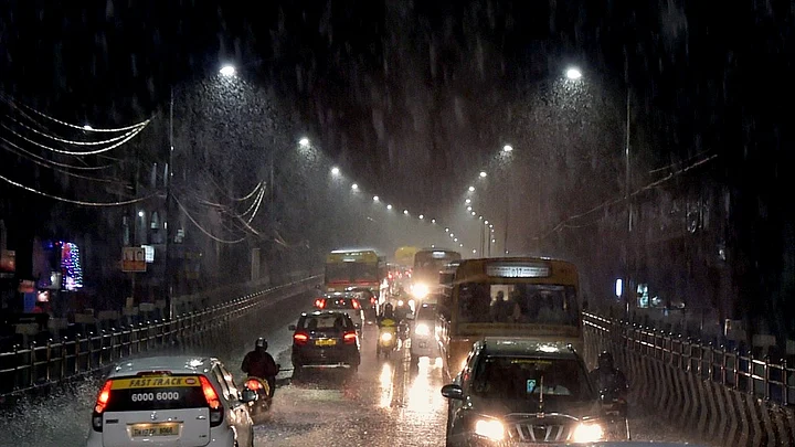
Coastal Tamil Nadu is bracing for heavy downpour and strong winds because of the depression over the Bay of Bengal that is likely to intensify into a cyclone Nivar and cross the coast at around 6 am on Wednesday, 25 November.
The depression is moving in a westerly direction towards north Sri Lanka and south Tamil Nadu coast, the coastal areas of the southern state is expected to receive heavy rain between 23-26 November. A low pressure over south-west of Bay of Bengal is very likely to intensify into a cyclonic storm during next 24 hours and move towards the Tamil Nadu-Puducherry coast.
The state has also issued alerts informing fishermen to return to the coast.
The cyclone is expected to bring in heavy to extremely heavy rains in Rayalaseema and south coastal Andhra Pradesh districts on 25 and 26 November.
Six teams of the National Disaster Rescue Force have been sent to Cuddalore and Chidambaram districts in Tamil Nadu.
The Met forecasts wind speed of 50 to 60 kilometre per hour.
People in low-lying areas have been asked to shift to safe zones, monitoring officers are on alert and fishermen have been asked to not venture into the waters. The depression lies about 550 km southeast of Puducherry and 590 km southeast of Chenani.
In 2015, unprecedented rains had led to floods in Chennai.
However, officials have said there is no concern for worry as the levels in all the dams are within safe limits.
Minister for Electricity, Prohibition and Excise P Thangamani said, “The electricity department is ready to handle the relief works. Power lines will be disconnected while the cyclone makes a landfall to avoid untoward incidents. We have given preference to Cuddalore since heavy rainfall is expected in the region.”
Public can call the helpline 1992 for electricity-related grievances.
Senior meteorological scientist, KS Hosalikar tweeted, “...Low pressure area over southwest and adjoining southeast Bay of Bengal persists....very likely to concentrate in depression...and intensify in Cyclonic Storm in next 24 hours. Very likely cross between Karaikal and Mahabalipuram on 25 November noon.”
Pradeep John, a weather blogger pointed out that there could be two different scenarios:
1. The landfall could be in Vedaranayam to Karaikkal on 24-25 November with wind speed of 70 km/hr. Tiruvarur, Nagai, Thanjavur, Perambalur, Ariyalur and Karaikkal will experience extreme rainfall, Trichy, Namakkal, Salem, Vilupuram, Tiruvannamalai, Kallakuruchi, Vellore, Cuddalore, Pondy, Chennai, Tiruvallur, Kancheepuram, Ranipet, Chengalpet to experience very heavy rains.
2. If the landfall is in Karikkal to Chennai between 24-25 November with 120-140 km/hr wind speed, extreme rainfall in Cuddalore, Pondy, Villupuram, Kancheepuram, Vellore, Tiruvannamalai, Ranipet, Chengalpet and very heavy rainfall in Kallkuruchi, Nagai, Karaikkal, Permablur, Ariyalur.
(At The Quint, we question everything. Play an active role in shaping our journalism by becoming a member today.)
